Richinbar Mine
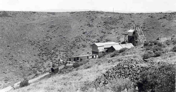
Richinbar Mine - Photo from 1940 - Courtesy of Arizona Geologic Survey files
Wednesday, July 27, 2011
John Townsend - New arrangement
Please refer to my prior blogpost for information about John Townsend. I added a mandolin part and inserted instrumental breaks between the verses. Each song that I write is based on historical research and my experiences hiking and 4-wheeling in the mountains of Yavapai County. I hope that you enjoy the song.
Friday, June 24, 2011
The Ballad of the Hard Rock Miner - new arrangement
This is a new arrangement of The Ballad of the Hard Rock Miner. I hope that you enjoy it. I am pleased to include several period photographs courtesy of the Mohave Museum of History and Art.
This song is inspired by "Deep Enough-A Working Stiff in the Western Mine Camps" - University of Oklahoma Press - by Frank Crampton. Many thanks to Ed Romanski of the Desert Caballeros Western Museum in Wickenburg, Arizona, for recommending this book to me. Ed is a transplanted New Yorker, like me, with his boots firmly rooted in Arizona's history. The heritage and history of Arizona needs to be discovered on foot, horseback, and in a 4-wheel drive truck. Many of the most interesting places are not marked on most maps. There is an abundant supply of accurate historical information that is readily available to the amateur historian: historical societies, foundations, archives, and libraries have been posting documents, maps, and photos on websites that are easily accessible. In addition, many books are available (both re-issues of out-of-print books and newly written) about Arizona mining history.
The historic maps of Arizona display dense clusters of mines and mining camps that were centers of intense activity in the period 1880-1930. Names like Chloride, Constellation, Stanton, Gillette, Tiptop, Humbug, and Bradshaw City were the centers intense prospecting, mining, processing, and community life. Many of these historic sites do not make the cut of "ghost town" tourist books. Many of them are located within 5 miles of highways and interstates. Others are easily accessible in high-clearance vehicles via forest service roads and jeep trails.
"Deep Enough" is essential reading for anyone wanting to know about the day-to-day life in the western mining camps in the early years of the 20th century. The song describes the life of a "hard-rock stiff" who works in a mine for ten days, and then moves on to the next mine. Miners of the day were very mobile, roaming the country from Butte, Montana to Bisbee, Arizona. The work rules of the day required a minimum of ten days work in order to draw a paycheck.
The song expresses the realities of a dangerous occupation, the swaggering pride of a highly skilled craftsman, and the pleasures that were available in the mining camps and towns along the way.
The Rand McNally Official 1925 Auto Trails Map is courtesy of the University of Kansas Libraries. The song is copyrighted by Robert T. Gibney 2011.
Thursday, June 23, 2011
John Townsend
John Townsend
John B. Townsend died on September 16, 1873. According to historical accounts, he was lured away from his family farm by a group of Apache braves, who ambushed him as he cleared the ridge above Dripping Springs. Townsend became a legendary Indian fighter after he relocated his family from Texas to Yavapai County, Arizona in 1868 (estimated). He was a Confederate soldier in the Civil War.
The only known photograph of John B. Townsend is stored at the Sharlot Hall Archives:
http://sharlot.org/img/detail_htmls/4370po0648pc.html
There are a number of well-established farms located along the Agua Fria River. The modern-day Young's Farm located in Dewey is a good example. The ranch owned by Nathan and Herbert Bowers was located at or adjacent to Young's Farm at the intersection of Hwy 69 and HWY 169. A description of the 1871 cattle theft from the Bowers Ranch is included in my previous blog post. The historical records indicate that the Townsend farm was located forty miles from Fort Whipple along the Agua Fria River. A modern-day farm is located in this approximate location. Further research is needed to ascertain the exact location.
A high percentage of published information about John B. Townsend is likely to be inaccurate. For example, there are various reports of the number of Indians killed by Townsend. The highest reported number is 65.
My song attempts to capture the experiences and emotions of pioneers living in Yavapai County during the 1870's. The physical challenges and hardships of the pioneers become clear when a modern Arizonan considers:
• Walking one thousand miles along the Leach Wagon Road from Texas to central Arizona
• Living forty miles from the small settlement of Prescott and the security of Fort Whipple
• Relying on a widely scattered network of neighbors from Walnut Grove to Camp Verde for security and social interaction
My goal as a historian and song-writer is to present the events of the past in an engaging way by telling stories about important people and events in Arizona's early days. The successes and failures of Arizona's pioneers may capture your imagination, and inspire you to learn more about our not-so-distant past.
The images that accompany this song begin with a map of the Leach Wagon Road from the David Rumsey Map Collection. The two photos that follow are recent photos taken along the San Pedro River showing the well-worn track of the Leach Wagon Road. The remaining images (Google Earth, Topo Map, Photographs) show the relative locations of Prescott/Fort Whipple, Bowers Ranch, John Townsend's Ranch (possible location), Dripping Springs, and Townsend Butte. The final photos are looking south from the ridge above Dripping Springs. Townsend Butte is the flat-topped hill visible in the distance. The final photo is of the Townsend Family headstone in the Masonic Cemetery, Prescott, Arizona. Townsend was buried at Dripping Springs in 1873 and re-interred at the Masonic Cemetery.
The song is copyrighted by Robert T. Gibney 2011.
Sunday, June 19, 2011
John B. Townsend - Arizona Pioneer and Indian Fighter
Photo of John B. Townsend

This story begins with a non-descript hill, named Townsend Butte, located near Cleator, Arizona, about halfway between Crown King and the I-17 freeway. Although I have driven past the hill hundreds of times, and scrambled to the top to view an Indian ruin more than 10 years ago, I never knew the story behind the hill’s name. The steep slopes, the lack of any trails, and acres of loose rock would discourage all but the most motivated hikers from venturing to the top.
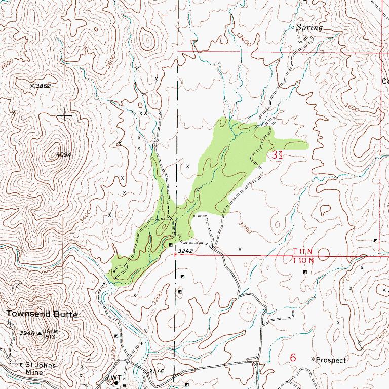 |
| Townsend Butte with Dripping Spring at the Upper Right Corner |
A cursory internet search yielded the name John Townsend, along with a few brief newspaper articles. My curiosity was peaked when a friend informed me of the local legend: John Townsend was killed by Indians at the top of the butte. A good murder mystery is suitable motivation for a historical research project. My initial questions were:
1- Why was Townsend killed by the Indians?
2- Was their some reason for the murder occurring at this location?
I was skeptical about the location of the killing based on my experience scrambling up the steep slopes 10 years ago: how could a murder occur at the top of such a formidable defensive position?
Here is the story of John B. Townsend:
The following is excerpted from:
“The Townsend Expedition”, by James N. Barney and“John B. Townsend His Fame Was the Indians He Killed”, by Claudette Simpson Sept 20, 1974 Prescott Courier
John Townsend left Bernard County (around 1868), Texas with a wagon train of several other families. He brought his wife, a four-year-old daughter, and a two-year-old son as far as Prescott. Here he settled on a ranch at Agua Fria and raised grain and hay which he sold to the government.
The Indians were hostile to the newcomers in Yavapai County then and townspeople thought Townsend a brave man to settle in an isolated region and withstand Indian attacks. Often he was the only man on the place and defended his family with a double-barreled muzzle-loading shotgun. He couldn’t get shots for his gun so he hammered lead balls out and cut them into slugs about as big as a grain of corn.
On the 5th day of June, 1871, a large band of hostile Indians made an attack on the ranch of Bowers Brothers, Herbert and Nathan, located on the Agua Fria River, about 20 miles from Prescott. The savages killed one of the two herders and ran off about 137 head of horses, mules and cattle; the other herder escaped and, eluding the Indians reached the ranch with word of the attack.
The Indians had no sooner obtained possession of the herd that a messenger was dispatched to convey news of the outrage to the people of Prescott. Another courier was sent to Camp Verde asking for help from the commander of the military forces stationed there. Upon receipt of the news at Prescott, a party of eleven citizens volunteered their services to go in pursuit of the Apaches, and about midnight this little force was already mounted and on the way to the scene of the depredation. Arriving at the Agua Fria settlement they were joined by a party of five citizens from that valley, and early the following morning the whole force, sixteen determined and experienced Indian fighters, under the leadership of John B. Townsend, took up the trail of the savages, which they followed for a distance of 35 miles.
Soon after leaving camp the next morning, the 7th, they met a detachment of troops from Camp Verde, also in pursuit of the same Indians. The soldiers were under the command of Lieutenant Charles Morton, and after a brief conference between the military and civil leaders, the two pursuing forces were combined under the command of Lieutenant Morton and the pursuit at once resume with fresh vigor and encouragement. After traveling 25 miles to the Verde River, the command went into camp at a late hour in the evening. On the evening of the 8th they again took up the trail, which they followed for a distance of 20 miles, and at one o’cloock in the afternoon came upon a good-sized Apache rancheria, which they quickly surrounded and attacked, killing 31 of its…dwellers…They came upon (more Apaches) after crossing the divide between Big Verde and Tonto Creek, and a desperate fight immediately ensued, which resulted in the killing of 23…Indians…
The Prescott portion of the citizen volunteers reached home on Sunday morning, the 18th, and brought the first tidings of the great success attending the pursuit. The news that the raiding Indians had been overtaken and fifty-six of their number killed, spread quickly and preparations were immediately set on foot by Prescott citizens for the property celebration of the event…In consideration of the great service he had thus rendered the Territory he was presented by Prescott citizens, on Thursday, June 22, 1871, with a beautiful Henry rifle, of the latest improved patent, as a token of their esteem. On one side of the stock was a silver plate…which bore the following inscription: Presented to J.B. Townsend By the citizens of Prescott, June, 1871, HONOR THE BRAVE!
But time was running out for the Indian fighter. Perhaps he sensed it. Ed Wright related this scene in his letter. “Along in the late fall, after I burned out, we heard the government was going to sell government horses at Camp Verde. Your father, Theodore Boggs, and myself went over to Camp Verde to the sale to buy some horses, as I hadn’t been able to buy any since I had my horse and mule burned up by the Indians. Just before we got to the edge of the camp, there were a bunch of Indians, old men and old squaws and three or four young squaws with a lot of children ranging from little babies up to 14 or 15 years old.
“I don’t know whether they were brought in by the soldiers or come in from starvation, and as we rode by they were pointing toward your father and Boggs said, ‘John, they are taking about you,’ and your father said, ‘Yes, they know me.’ I told him they would get him. He said, ‘If you and Theodore are here when they get me, I want you to look after Lizzie and the children till they are provided for.”
They got him. The date was September 16, 1873. Single-handed he left the ranch to trail eight Indians who had raided his home garden on the Agua Fria River. According to an interview years later with his daughter, his last words to his wife and children who had left the house to pick green beans were, “don’t go any farther than the fields”. He was never seen alive again.
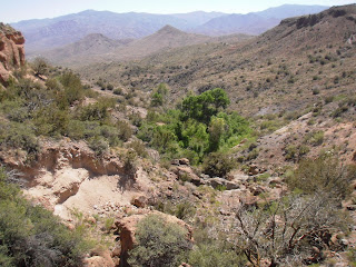
Townsend followed the small band of Indians. He climbed a mountain in order to see farther and at the highest point, Dripping Springs, he was slayed with bullets. From the locations of the wounds he must have died immediately…He was found by a party of his fellow scouts who took the trail of the horse and followed it back…
Dripping Springs is somewhat like the lime formation of Montezuma’s Well. Townsend had evidently ridden around the rim rock above and had dismounted and stopped on the very edge to look over the country with his field glass. He was shot by some Indians in the cliffs below. He fell back with arms outspread. When the party found him his hat was over his eyes, the field glass was about 20 feet away from the body and his gun was gone, but had evidently fallen over the cliff as he fell back. Townsend was buried where he fell, but his body was later taken to Prescott and given a Masonic burial.
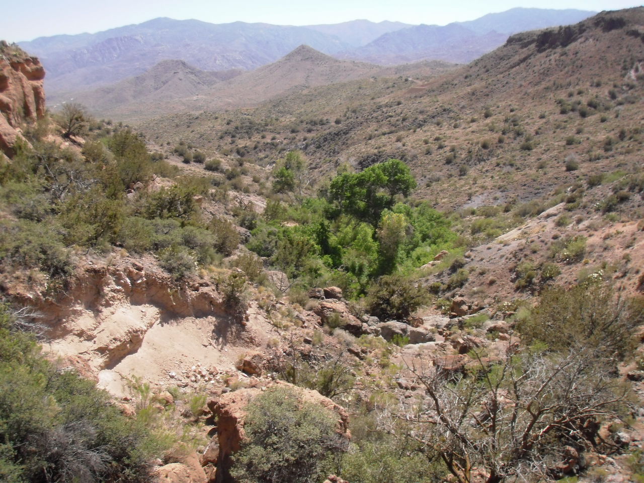
I have included recent photos that were taken from the top of the sandstone cliffs directly above Dripping Springs. From this vantage point, you can look south to see Townsend Butte (photo 1), and look down to see Dripping Springs (grove of trees) and Townsend Butte in the distance (photo 2).

The lyrics of my new song pose the question, “Was it anger, fear, or hatred that drove him to the end?” We will never know the answer to this question, but we can understand the tragic consequences that result whenever a person is driven to extreme behavior which is ultimately self-destructive. Although he was acclaimed as a famous Indian scout and fighter in Territorial Arizona, our historical perspective leads us to ask questions that will remain unanswered. Was it anger, fear, or hatred that drove him to the end?
Stay tuned for my new song. I will post it later this week.
Monday, May 9, 2011
The Ballad of the Hard-Rock Miner
The Ballad of the Hard Rock Miner
This song is inspired by "Deep Enough-A Working Stiff in the Western Mine Camps" - University of Oklahoma Press - by Frank Crampton. Many thanks to Ed Romanski of the Desert Caballeros Western Museum in Wickenburg, Arizona, for recommending this book to me. Ed is a transplanted New Yorker, like me, with his boots firmly rooted in Arizona's history. The heritage and history of Arizona needs to be discovered on foot, horseback, and in a 4-wheel drive truck. Many of the most interesting places are not marked on most maps. There is an abundant supply of accurate historical information that is readily available to the amateur historian: historical societies, foundations, archives, and libraries have been posting documents, maps, and photos on websites that are easily accessible. In addition, many books are available (both re-issues of out-of-print books and newly written) about Arizona mining history.
The historic maps of Arizona display dense clusters of mines and mining camps that were centers of intense activity in the period 1880-1930. Names like Chloride, Constellation, Stanton, Gillette, Tiptop, Humbug, and Bradshaw City were the centers intense prospecting, mining, processing, and community life. Many of these historic sites do not make the cut of "ghost town" tourist books. Many of them are located within 5 miles of highways and interstates. Others are easily accessible in high-clearance vehicles via forest service roads and jeep trails.
"Deep Enough" is essential reading for anyone wanting to know about the day-to-day life in the western mining camps in the early years of the 20th century. The song describes the life of a "hard-rock stiff" who works in a mine for ten days, and then moves on to the next mine. Miners of the day were very mobile, roaming the country from Butte, Montana to Bisbee, Arizona. The work rules of the day required a minimum of ten days work in order to draw a paycheck.
The song expresses the realities of a dangerous occupation, the swaggering pride of a highly skilled craftsman, and the pleasures that were available in the mining camps and towns along the way.
Thursday, May 5, 2011

Single Jack Miner
According to Frank Crampton, in his book "Deep Enough" 1982 University of Oklahoma Press, "After mucking came instruction in single and double-jack drilling. Usually hard rock stiffs could work double or single as they chose....Double jacking was impossible in narrow stopes less than sixteen to eighteen inches wide, where the holes to be drilled were mostly overhead anyway...They taught me how to point drill holes, and why; and to drill without going-by and breaking my hand, if the single jack missed the steel drillhead. Pointing each drill hole was damned important. Swinging the ordinary four-pound single jack fifty times a minute, for hours at a time was bad enough, but John T trained me on what he called a "Dago" which weighed four and one-half pounds and had a tapered face smaller than the regular single jack hammer head. The fewer holes one had to drill, the less work there was to do: drilling with the "Dago" and pointing holes so that each would break out the most rock was the answer."
Experienced single jack miners struck the drill approximately 50 times per minute, while rotating the drill a 1/4 turn between hammer strikes.
Photo provided by LunaCommon.org - UCR California Museum of Photography
Thursday, April 14, 2011
Walnut Grove - 1890
According the State of Arizona 2009 Multi-Hazard Mitigation Plan,
"February 22, 1890, the most significant dam failure experienced in the State occurred in Walnut Grove. The dam failed due to overtopping and the ensuing flood caused an estimated 150 deaths and extensive destruction of property. The failure was blamed on inadequate capacity of the spillway and poor construction. Located 30 miles by river north of Wickenburg on the Hassayampa River, the dam was built to provide water for irrigation and gold placer mining. The rock fill structure was 110 feet high, 400 feet long, had a base width of 140 feet, a top width of 10 feet, and a spillway of 5-20 feet long. The lake was 2.5 miles long by one mile wide covering over 1,000 acres, an average depth of 60 feet. Based upon various accounts of the Walnut Grove Dam failure, the weather at the time was rain and melting snow. The day before the breach, water in the lake rose rapidly at the rate of about one and one-half foot per hour. The spillway was enlarged to allow excess water to escape but the effort was insufficient to stop water from running over the top. A sheet of water three feet thick reportedly poured over the dam top for six hours. Between 1:00 - 2:00 A.M. on February 22, 1890 the dam broke and the lake drained in one to two hours. The water rushed down Box Canyon, a narrow, steep canyon in a body 80 feet high. Floodwaters reached Wickenburg, 30 miles downstream in two hours and was reportedly still in a column 40 feet high."
I invite you to read "Arizona's Worst Disaster - The Hassayampa Story - 1886-2009" by Jim Liggett. Copies are available at the Desert Caballeros Western Museum in Wickenburg, Arizona.
Two important men were directly involved in the incident:
W.O. "Buckey" O'Neill, the Yavapai County Sheriff, is a legendary historic figure who went on to serve with Theodore Roosevelt's Rough Riders. Read "Rough Rider: Bucky O'Neill of Arizona" by Dale L. Walker for more information about O'Neill's important role in Arizona history.
Alexander Brodie was employed as the superintendent of the Walnut Grove Dam. Brodie went on to serve with Theodore Roosevelt's Rough Riders, and as Territorial Governor of Arizona from 1902 to 1905.
All images are used by permission of the Arizona Pioneer & Cemetery Research Project. The song is copyrighted by Robert T. Gibney 2011.
Friday, April 1, 2011
Jack Swilling's Lament
Jack Swilling died in Yuma County Jail on August 12, 1878 after being arrested for a crime that he did not commit. He was a leading figure in the early days of the Arizona Territory: He served in Arizona for the Confederate Army during the Civil War, he led and protected many groups who traveled across the southwest, he was an original settler in the Salt River Valley, he formed a company that developed the first irrigation canal in the modern era for agriculture in the Salt River Valley, and he was a leader in prospecting and developing new mining claims and mining communities.
This music expresses the thoughts and emotions expressed in his last letter:
To the public
Jack Swilling whose doors have been open to the poor alike with those of the rich and plenty, looks forth from the prison cell to the blue heavens where reigns the Supreme Being who will judge of my innocence of the crime which has been brought against me by adventurers and unprincipled reward hunters. I have no remorse of conscience for anything I have ever done while in my sane mind. In 1854 I was struck on the head with a heavy revolver and my skull broken, and was also shot in the left side, and to the present carry the bullet in my body. No one knows what I have suffered from these wounds. At times they render me almost crazy. Doctors prescribed years ago, morphine, which seemed to give relief, but the use of which, together with strong drink, has at times as I have been informed by my noble wife and good friends made me mad and during these spells I have been cruel to here, at all other times I have been a kind husband. During these periods of debauch, caused by the mixture of morphine and liquor, I have insulted my best friends, but never when I was Jack Swilling, free from these poisonous influences. I have tried hard to cure myself of the growing appetite for morphine, but the craving of it was greater than my will could resist. I have gone to the rescue of my fellowmen when they were surrounded by Indians. I have given to those who needed. I have furnished shelter to the sick. From the Governors down to the lowest Mexican in the land have I extended my hospitality, and oh, my God, how I am paid for it all. Thrown in prison, accused of a crime I would rather suffer crucifixion than commit.
Taken from my wife and children, who are left out in the cold, cold world all alone. Is this my reward for the kindness I have done to my fellowman, and the pay I must receive for having done a Christian act with Munroe and Kirby, that of going after the bones of my poor friend snively and taking them to Gillett and burying them by the side of my dear child. George Munroe, Andy Kirby, and myself are as innocent of the charge brought against us of robbery as an infant babe. We went out to do a Christian act.
Oh God, is it possible that poor old Jack Swilling should be accused of such a crime? But the trouble has been brought on by crazy, drunken talk. I was willing to give up my life to save Munroe and Kirby, as God knows they are innocent. Oh, think of my poor babies and you would know that I would not leave them for millions of money. I am persecuted and prosecuted and prosecuted until I can bear it no longer. Look at me and look at them. This cruel charge has brought me for the first time in my life under a jailer's key. Poor L.G. Taylor, who I liked and tried to help, has been one of those who has wrought my ruin, and for what I cannot conceive, unless it was for reward money or to rob my family of the old ranch. The reason I write this is because I may be found dead any morning in my cell. I may drop off same as poor Tom McWilliams did at Fort Goodwin. My persecutors will remember me. And may God help my poor family through this cold world, is my prayer.
Read more details about Jack Swilling at:
http://www.apcrp.org/SWILLING_Jack.htm
All images are used by permission of the Arizona Pioneer & Cemetery Research Project. The song is copyrighted by Robert T. Gibney 2011.
Wednesday, March 23, 2011
Just Another Day in the Crown King Saloon
This is my new song based on the story of Justice Reynolds and Andres Bustamente described in my last blog post. I hope that you enjoy it. Feel free to leave comments on the blog.
Monday, March 21, 2011
Sept 10, 1904 - Justice Reynolds Murdered by Andres Bustamente
Here is a story that needs telling - A drifter murders a justice of peace in a Crown King saloon in 1904. The Territorial Governor contributes $250 reward money in addition to $100 from the county sheriff. The story captured the attention of the entire state with news stories printed from Bisbee to Flagstaff. The accused murderer eludes capture for 9 days and then severely beats one of the three deputies who attempt to capture him while he slept.
According to the Bisbee Daily Review, "Justice Killed Near Prescott...Posse Surrounds Murderer and Will Close in This Morning...Judge Reynolds Was Widely Known in the Territory - Was Shot Through the Heart By Mexican Because of Woman". This information is based on the story as report in the Coconino Sun, Arizona Silver Belt, and the Bisbee Daily Review.
Here are the facts as reported:
Justice Reynolds was 60 years old. He was in Crown King on official business, but he spent the much of the day on September 10, 1904 in the local saloon. He spent part of the day drinking and quarreling with Andres Bustamente, a 25-year old man from Mexico. They argued several times about a beautiful Mexican woman. Bustamente may have been a mine worker, or a drifter who frequented the local saloons. After shooting and killing Reynolds, Bustamente "sauntered into another saloon", but quickly left. "Bustamente is said to have a bad reputation and the Mexicans throughout the area are afraid of him".
A $100 reward was offered by the County Sheriff and a $250 reward was offered by Governor Brodie of the Arizona Territory. Bustamente was described as 5'10" and 150 pounds with a scar from a bullet wound on the right side of his neck. Sheriff Roberts led a posse of twenty men in search of Bustamente after the shooting. A miner by the name of Dennis Welsh encountered Bustamente on September 16th near Hot Springs Junction and reported him to the Sheriff. "Bustamente was captured this morning (Sept 19) after a hard fight with three officers. He was tracked to the house of a woman in Columbia (Near Humbug) by three of Sheriff Roberts' deputies and surprised while asleep. As soon as awakened Bustamente got his rifle and before Deputy Mike Welch could defend himself he had been struck two vicious blows over the head, falling to the floor in a senseless condition. The other two deputies closed in on the Mexican, and by beating him severely with revolvers were able to handcuff his wrists."
"Bustamente, charged with the murder of Judge Reynolds at Crown King was yesterday lodged in the county jail. His passage from the depot to the jail was thronged with curious people, fully 100 following him to the portals, from where he may emerge to the scaffold. He appeared to take a keen delight at the notoriety he was receiving and expressed his satisfaction with a broad grin."
My song will explore the ambiguity of the situation: Why did Justice Reynolds spend the day with Bustamente? Was the woman who was the subject of their arguments the same woman who was with Bustamente the day that he was arrested? Was Bustamente protecting Maria in the only way that he knew? While all of the news accounts focused on the "Mexican" no one talked about Reynolds.
These two powerful men collided during a violent period in Arizona history. While Bustamente led a short and violent life, Justice Reynolds may have had a more colorful life than first appears.
Look for my song to be posted on this blog in the coming days.
Saturday, March 19, 2011
Humbug Open House
 |
| Mill at Humbug Creek |
The public was invited to the Humbug Open House on March 3rd, sponsored by Dave Burns, Neal Du Shane, and the Arizona Pioneer and Cemetery Research Project. This is an annual event that offers a rare view of one of Arizona's best-preserved ghost towns. Dave led several groups through a tour of the original home-site of Charles Champie, the original smelter, the home of Frank Hyde, the cemetery, and mill. You can read more about the history of Humbug by referring to this link History of Humbug.
Neal led our caravan of vehicles about 10 miles north of Lake Pleasant on Saturday morning. The route passed through several gates that were unlocked for the open house. Small group tours were offered to the Columbia and El Paro Bonito mines. At its peak, approximately 200 people lived at Humbug. The current owners are working to preserve the remaining structures, while providing the public with an opportunity to enjoy a day learning about one of Arizona's unique ghost towns.
Thursday, March 3, 2011
The Richinbar Mine (updated song)
This is an updated version of The Richinbar Mine:
- Added a final verse
The miners all left without telling their story.
A few men are buried, the end of the line.
If you go, say a prayer for the miners and families
Their memories live at the Richinbar Mine
- Added historical photos courtesy of the Arizona Pioneer and Cemetery Research Project and the Sharlot Hall Museum
- New musical arrangement
Please post your comments to provide me with your feedback about the song. Bookmark my blog and check back to see new posts about Arizona history, mining, hiking, and music.
Sunday, February 27, 2011
Bradshaw Mountain Road
Here is a new song that I just wrote about the Bradshaw Mountain Road, in Yavapai County Arizona. The song tells the story of the hard rock miners who lived and worked in Middleton and Crown King during the boom-bust period of 1880-1930. Frank Murphy developed the railroad to transport ore from the mines in the area. The train was abandoned in 1926, after only 22 years of service. The existing Crown King road uses the old railroad right-of-way starting at the first switchback.
My connection with the area began in the 1980's when my family and I purchased a cabin in Crown King. Since that time I have tried to learn as much as possible about the mining era. I have been fortunate to know several people with direct knowledge of the early mining days. In addition, I enjoy hiking and 4-wheeling in the area. There is increasing amount of material being posted on the internet in recent years. Two of the most valuable sites are:
http://www.apcrp.org/index.htm - Arizona Pioneer and Cemetery Research Project
http://www.tigergold.com/ - Tiger Gold Company
I have developed an interest in song-writing over the past year. I enjoy combining my long-time interest in music, words, and the Arizona outdoors. Please let me know your thoughts about my music. I invite you to refer other interested people to my blog and You Tube songs.
Sunday, February 20, 2011
Richinbar Mine - Black Mesa
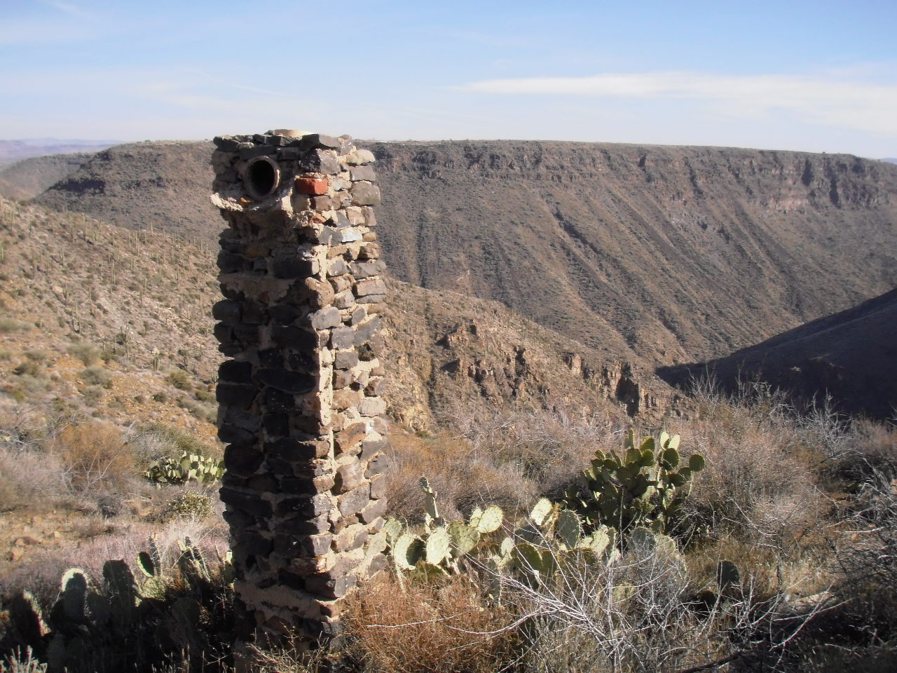
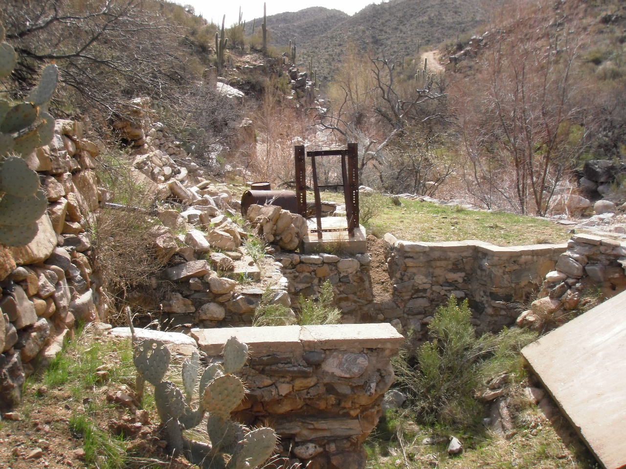
The best way to enjoy a hike on Black Mesa is to park your vehicle at the Badger Springs Exit of I-17. Start hiking due south along a dirt road right of way. The dirt road climbs a short, steep slope to reach the relatively level Black Mesa. Follow the dirt road and turn left at the corral and windmill, and continue about two miles. The Richinbar Mine is located at the top of a 1,000 foot cliff that forms the eastern edge of Black Mesa. The Agua Fria River is located at the bottom of the canyon, and Perry Mesa is the prominent mesa across the canyon.
The Richinbar Mine closed in 1937 after operating for forty-one years. It was one of the largest gold and silver mines in Yavapai County. Use great care to avoid all open mining shafts and tunnels when walking around the mine.
The photo of the Agua Fria River located at the bottom of the page was taken during the rainy season. Runoff from mountain snow can cause the river to flow at a very powerful rate. The rate of flow varies during the year from a peak in January-March to a trickle in the summer months.
Subscribe to:
Comments (Atom)